Stanton Drew - Sunday 27th November 2016
For my Dad's 70th Birthday, we spent the weekend based at a cottage on the south side of Mendip in Rodney Stoke, on the edge of the Somerset Levels. On the way back to Bristol we decided to stop at Stanton Drew to visit the standing stones around the village and have a late lunch in the Druid's Arms pub.
This visit to the Stanton Drew stone circles was really just a quick reconnaissance, so rightly doesn't fit with the overall concept of these treks. To visit Stanton Drew using public transport and on foot, the most convenient railway station is Keynsham (between Bristol and Bath). The stone circles can be approached by following the Two Rivers Way or various parallel rights of way up the River Chew from Keynsham.
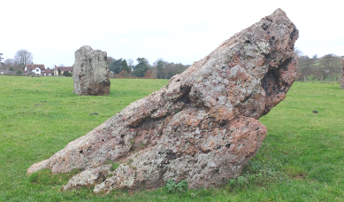
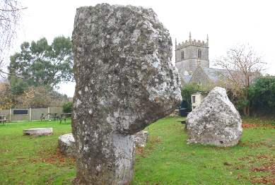
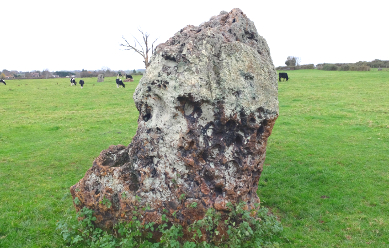
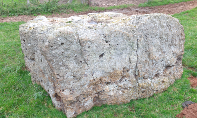
We had some expensive musical instruments with us, so my Mum kindly waited in the car while my Dad and I made a quick visit to the stones. The first stones you encounter are immediately next to the car park, in the beer garden of the Druid's Arms. Here there's a formation of three stones known as The Cove, two uprights facing each other and one recumbent stone behind. The largest standing stone shaped like a massive letter P. The recumbent stone is believed to have originally been standing, creating a three-sided horseshoe formation of giant stones. The construction is believed to date from the Neolithic, pre-dating the stone circles on the other side of the village.
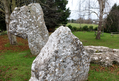
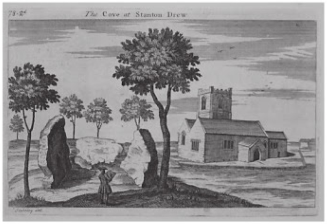
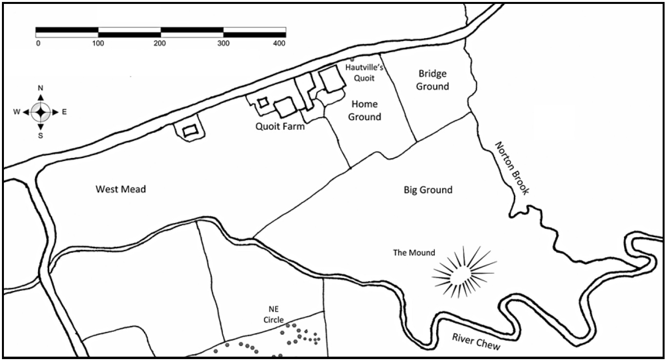
Stanton Drew is not the only place in Britain with a prehistoric "cove", there are two more: the central Avebury Cove and the Longstone Cove at the end of the former Beckhampton Avenue west of Avebury. Geophysical scans of the Cove at Stanton Drew suggest that it was originally surrounded by an earthen mound that extended northwards, towards what is now the pub. The cove stones potentially formed a great stone chamber inside a Neolithic long barrow.
Long barrows were typically used to inter the bones of the dead, and it's been suggested that they were used as portals between the world of the living and the dead. The chambers were a sacred space, a kind of prototype church where the spiritual leaders could commune with the spirits and seek guidance to solve the problems of the tribe. Rituals may have been conducted in the forecourt of the barrow, attended by an audience, before the shaman entered into the darkness within. The coves at Avebury have been observed to have acoustic properties, and the chamber at Stanton Drew may have been similar.
We left the pub garden and continued down the road past the pub, taking the first road on the right. This road curves around, doubling back to approach the Church of St Mary the Virgin. This church was constructed in the 13th century, and its positioning was no doubt influenced by the stones. The church tower is visible from all the stones around the village. Siting of Christian places of worship on former pagan sites is a common technique used by the Church to provide continuity and subsume earlier beliefs into Christian worship.
Before the road reaches the church, a signpost points to a left turning: STANTON DREW STONE CIRCLE ANCIENT MONUMENT. The side road winds past some residential properties, terminating at a gate. The stone circles are on private land, and the farmer charges £1 admission with an honesty box attached to gate. English Heritage provide a four-page A4 information leaflet to help visitors interpret the site.
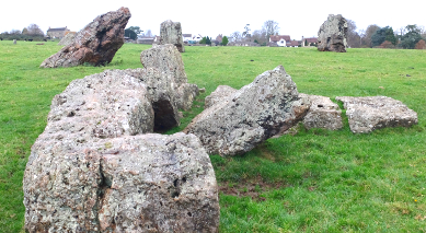
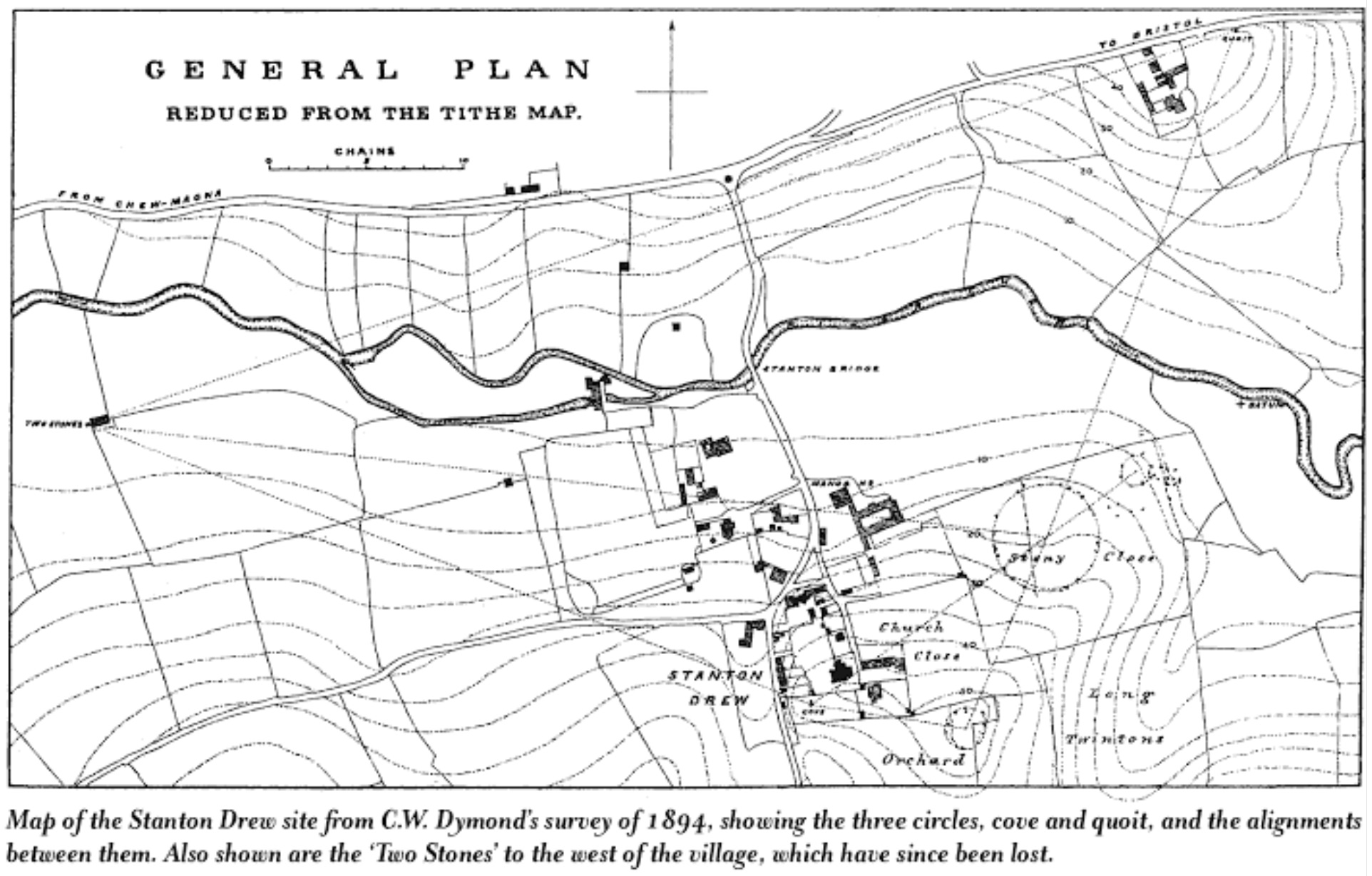
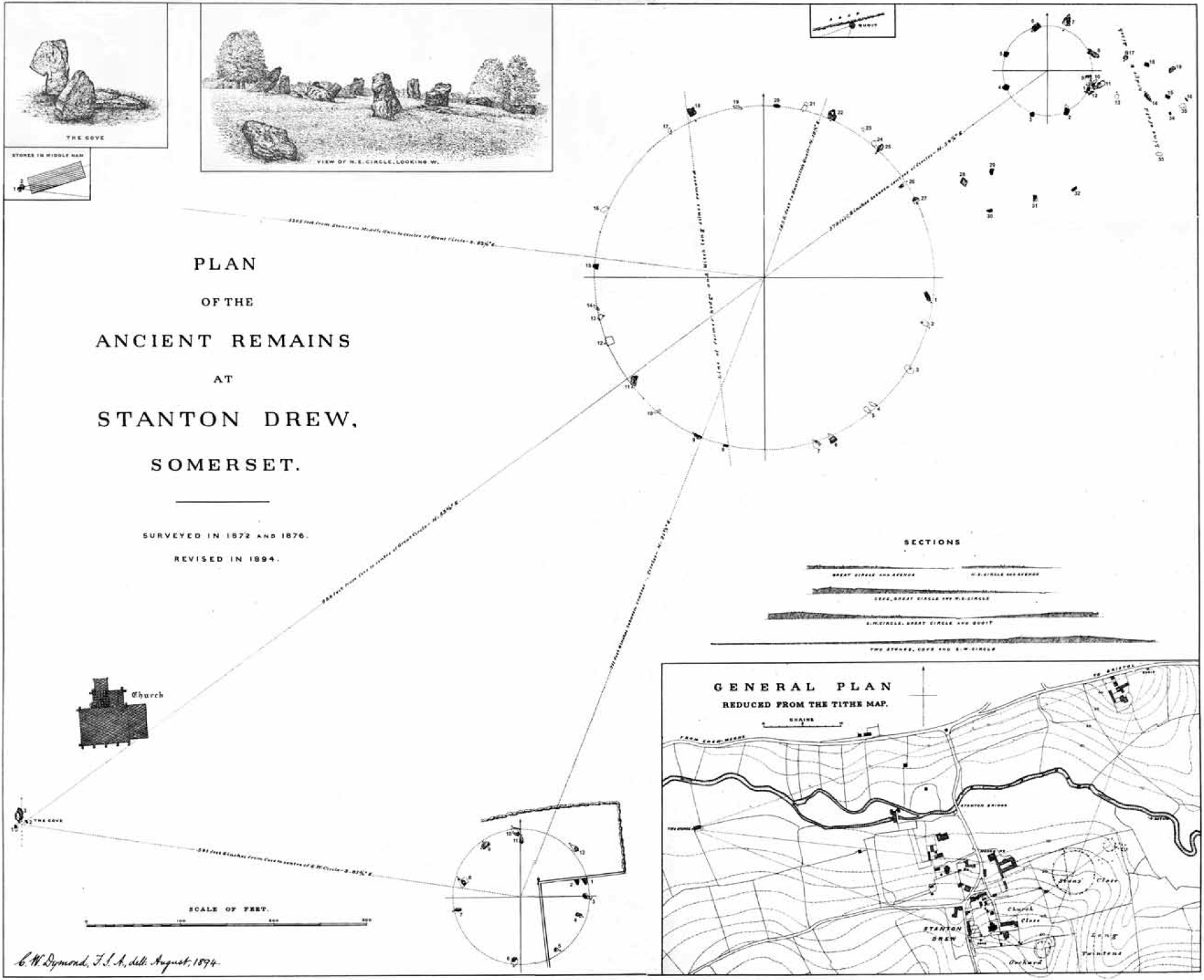
From the gate, a short path leads out into a large field known as the "Stone Close". This field contains the Great Circle with the North-East Circle immediately behind it. The ground slopes away gently downhill towards the River Chew. The largest stones are in the North-East Circle, giving the impression that the stones have gradually migrated downhill under the influence of gravity. The remains of a short stone avenue links the two circles, and there's a further short avenue approaching the North-East Circle from the river side. The stone circles and avenues are thought to have been constructed here between 3000 and 2000 BC, in the Late Neolithic or Early Bronze Age.
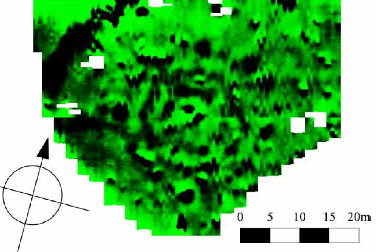
At 113m in diameter, the Great Circle is the second largest stone circle in Britain, second only to Avebury. The circle now is in a ruinous state with only a handful of stones still standing, the rest are recumbent, half-buried or missing. In 1997 English Heritage carried out a geophysical survey of the Stone Close, scanning the terrain in and around the Great and North-East Circles. The survey used magnetometry, a non-invasive technique which picks up magnetic anomalies in the ground to detect the presence of buried features such as pits and ditches. In 2010 Bath and Camerton Archaeological Society (BACAS) conducted a more detailed scan, using a variety of techniques, see these reports: http://www.bathnes.gov.uk/sites/default/files/sd_2010_report_low_res.pdf and http://www.bathnes.gov.uk/sites/default/files/sd_2009_report_low_res.pdf.
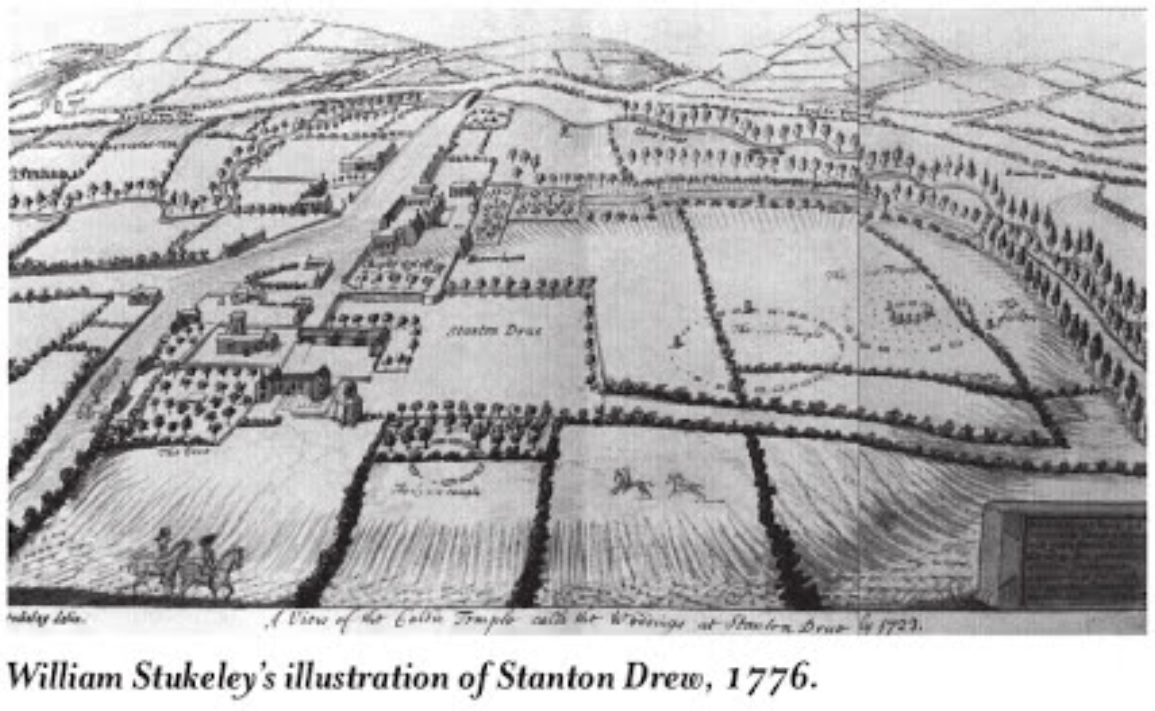
The results of the surveys were astonishing, revealing that the circles at Stanton Drew are just the remains of a much more elaborate and important site than had previously been imagined. Beneath the pasture within the Great Circle there's a pattern of buried pits, arranged in nine concentric circles, with further pits at the centre. The pits appear to be about a metre or more across, spaced about a metre apart around the outer ring. Just as remarkable was the discovery that the Great Circle is contained within a very large enclosure ditch, about 135 metres in diameter. This ditch is about 7 metres wide with a broad gap or entrance facing north-east. The presence of the ditch makes Stanton Drew a henge monument, similar in form to Avebury.
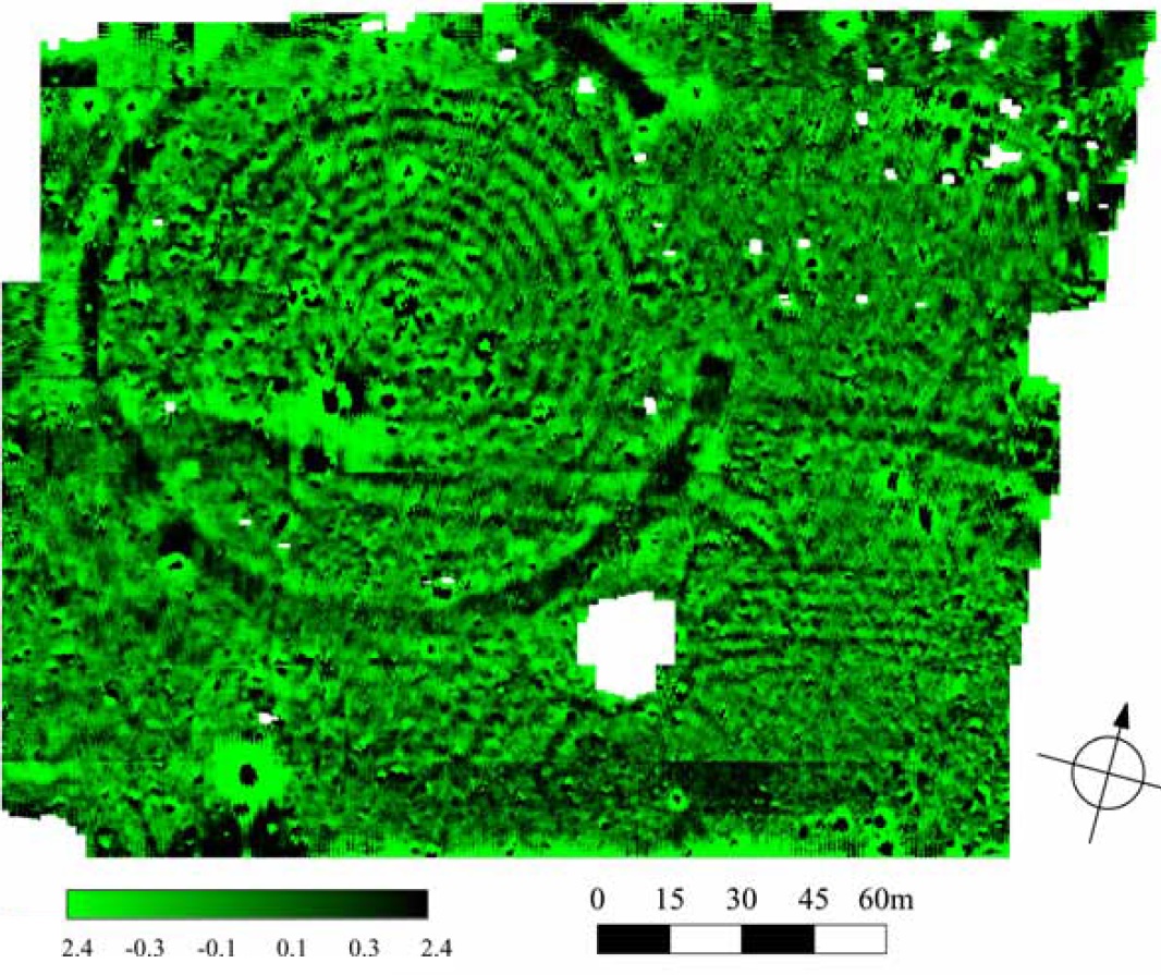
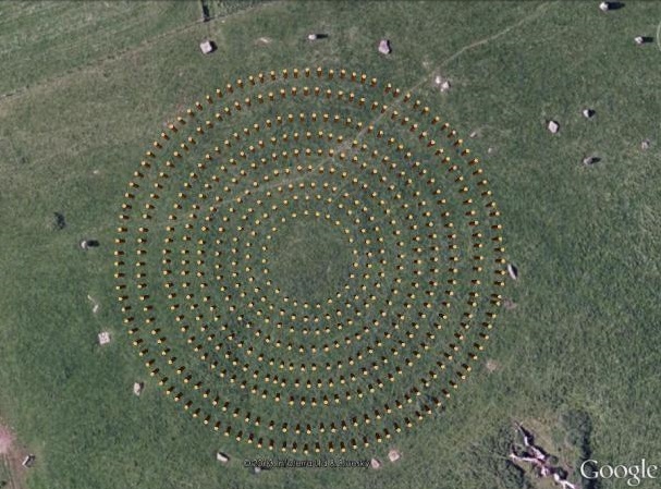
Several henges enclose stone circles, and some feature rings of pits. Sites that closely resemble Stanton Drew include Woodhenge, Durrington Walls and The Sanctuary in Wiltshire. At these and other sites the pits are known to have held timber uprights, although it is not clear whether these were part of roofed or open structures. It seems likely that at least some of the pit circles at Stanton Drew once held massive posts. The circles here are the largest and most numerous yet recorded at any site and indicate the investment of immense effort in its construction.
Recent discoveries such as the palisade enclosures at Avebury indicate that wood was a much more common material used in the construction of ritual sites that previously thought, being used before, after and together with stone. Our understanding of prehistoric sites has long been shaped by the remaining visible stones, and now with modern geophysical techniques I suspect that many sites will need to reappraised to identify if wood formed part of their construction.
The film Standing With Stones by Michael Bott and Rupert Soskin, includes a 3D visualisation of Stanton Drew, reconstructing what the Great Circle may have looked like in prehistoric times. The film shows nine concentric circles of timber posts, each up to a metre in diameter, surrounded by a ring of stones and a great circular ditch.
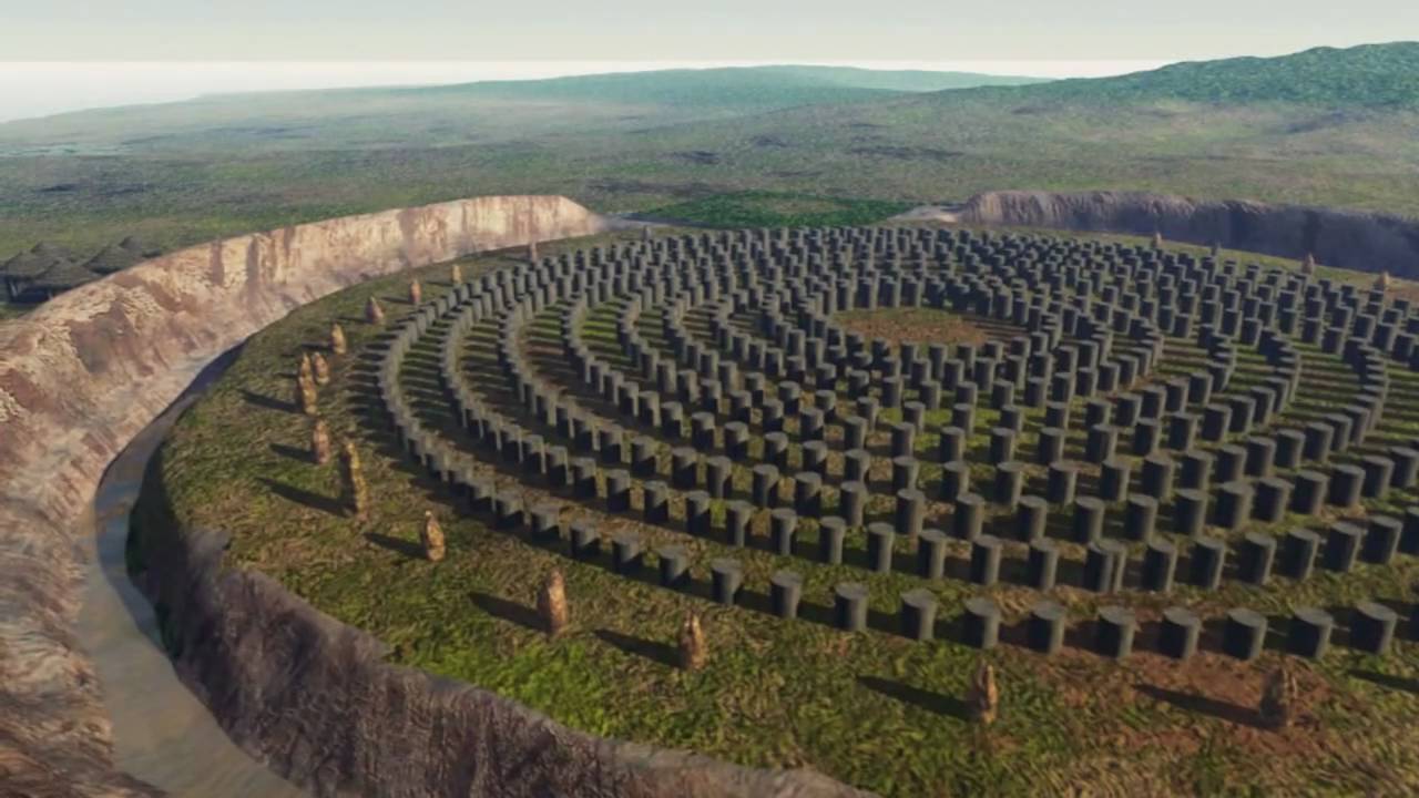
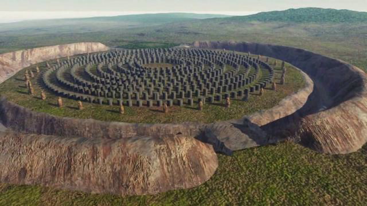
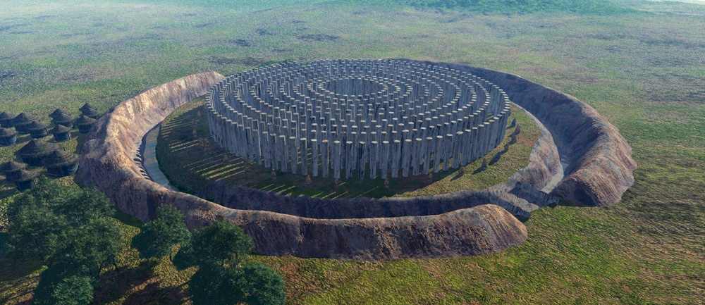
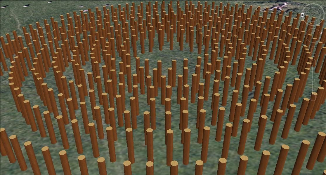
Rupert's interpretation is that this site was used for blood sports, with the timber posts providing an artificial forest, which could be used as cover for hunting wild animals. The ditch would have prevented the animals from escaping and the surrounding embankment would have allowed a crowd to view the spectacle from an elevated position.
Hunting prowess would have been a key skill at the time when humans were hunter-gatherers, potentially making leaders of men or granting them venerated status. As society shifted to subsistence agriculture, perhaps there was still a need to preserve the old skills and create an artificial hunting ground so that men could keep in practice, and to establish a pecking order amongst the men of the tribe.
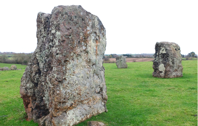
Today the North-East Circle is the most impressive circle, formed from some absolutely enormous blocks of stone. Aside from the stones at Avebury and Stonehenge, I suspect these are some of the largest stones erected in prehistoric Britain. The geophysical survey of the North-East Circle identified at its centre a quadrilateral of four pits aligned with the opposing pairs of the eight stones that comprise the circle. These may be ritual pits, or might be the holes for stones that were subsequently removed.
There's a well-known legend about the Stanton Drew stones, which tells how a wedding party was turned to stone. The party was held throughout Saturday, and after midnight a man clothed in black, the Devil in disguise, came and started to play fiddle for the merrymakers, continuing into Sunday morning. When dawn broke, everyone was turned to stone: the stone circles are the dancers, the avenues are the fiddlers and The Cove is the bride and groom, with the drunken churchman at their feet. The Devil promised to come back someday and play again for them. I suspect the story was concocted by the Church to link the site with Christian beliefs and encourage piousness among the parishioners.
On the day of my visit, it was a bitterly cold November afternoon. My Dad was feeling the cold, so hurried around the Great Circle and North-East Circle. I directed him to a stile crossing to the South-West Circle while I took some photographs of the two main circles. The stile emerges onto a right of way, and then there's a short walk across a field and another stile to reach the South-West Circle.
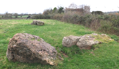
Of the three circles, the South-West Circle is in the most ruinous state, with all the stones recumbent and some half-buried. This circle has the most dramatic position, perched on a little hillock, raised above the surrounding ground, overlooking the village, the church and the other circles. The geophysical survey of the South-West Circle revealed three concentric rings of pits inside the circle, and a couple of central pits.
